Google Maps’ new feature that shows COVID-19 data was unveiled last week, allowing users to see important COVID data for the map they are looking at in Google Maps.
How to find real-time COVID-19 data on Google Maps
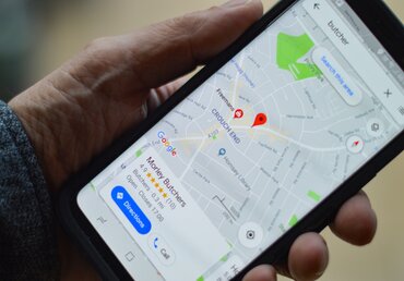
When opening Google Maps on your device, click on the layers button on the top right-hand corner of the app. Once that pops up, click on COVID-19 data. Once that is selected, the app will then show a seven-day average of COVID cases per 100,000 for the area of the map that you are looking at. It will also show an arrow-like indicator right next to the number of cases per 100,000 to indicate whether cases are trending upward or downward.
The COVID-19 data on the Google Maps app comes from three different data recording sources, including Johns Hopkins University, the New York Times, and Wikipedia. These outlets get their numbers directly from organizations such as big hospital networks, the World Health Organization, and other forms of credible number reporting.
This is the first navigation map to show COVID data on its app, giving Google Maps a distinct edge over its competitors of Waze and Apple Maps. Having COVID data on a map could help travelers make a determination on whether or not they want to travel to the destination they are looking at visiting. Furthermore, it could give more companies and organizations the ability to make more real-time decisions, such as canceling or postponing events in a certain area.
This is just the latest step in technology in a year where all of the big tech companies have had to innovate in more ways than ever due to an unprecedented pandemic. Apple introduced additional health measures in its new products, most notably the Apple Watch, which has new monitors to measure different kinds of heart issues and detect problems at an early stage. These steps are being taken to give consumers more information to make a decision based on their daily lives and how they want to go about them. With Google unveiling its maps feature, expect a response from both Waze and Apple Maps with COVID features of their own. In the Tech world, the one latest to the game loses the race.
Have Health Insurance Questions?
We hope that this information on COVID-19 data in Google Maps is helpful for you.
Insurance is oftentimes overwhelming and we want to shed light on the industry by answering your questions. Comment below and your question may be the topic of our next post!
If you liked this article, share it with your friends!
Empower Brokerage wants to help you find the insurance coverage you need and help you save money getting it. Stay on top of your health and give us a call at (844) 410-1320.
Get affordable health insurance quotes by clicking here.
See our other websites: